Monday, August 24, 2009

PbVille '09

It was yet another great weekend at the Leadville 100 "Race Across The Sky" I did not run it this year, but went up to help out, pace, and spectate. It was an unusually warm, dry year. The heat caused a lot of stomach issues among the runners and resulted in many DNFs (did not finish, or distance not finished).

Below is a picture of Ron next to his 5th wheeler. My tent is just visible to the right behind the table and barbecue grill. What a great weekend to tent; warmer and dryer than I have ever seen it in Leadville. 
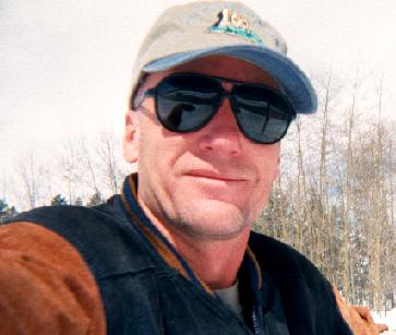
Ron and I had intended to climb Mt. Elbert, Colorado's highest peak, but instead volunteered to help mark the race course. We were responsible for marking the 10.5 miles between Twin Lakes and the turn around at Winfield. This is a beautiful stretch of course including 12,600 foot high Hope Pass. Here' a picture of me tying on some ribbon near the river crossing. Part of our duty was to scout out the area and find the most suitable place to cross the river. This can change year-to-year due to the different water levels and changing river channels.
Ron marking along the meadow crossing near Twin Lakes. This area is usually wet, with some water and nasty black-muck stretches that are more than ankle deep. This year it was just a wonderfully dry grasslands.
The main channel river crossing. In the background is the beginning of the 3000 ft. climb towards Hope Pass.
Ron and I were up for the 4am race start to see the runners off. Molly I posing for a shot.
Molly and Chris.
Karen and Pat.
Bob and Scott.
Ken Chlouber, age 70, preparing to go for the 100 miles again!
Norma and Ron.
Beauty and the Bob.
The crowd at the finish line with just over a minute to go. We were all madly cheering for a woman coming up the boulevard as the clock ran down. Unfortunately, after 30 hours of valiant effort, she came in just over a minute after the gun! There always some real drama and excitement at this finish line towards the end of the race.
Ken cheering on the runners and preparing to fire the shotgun to signal the official end of the race.
Medical aid to a finisher who was carried to the lawn after collapsing at the finish line.
And medical aid to another collapsed runner at the finish line.
The awards ceremony in the 6th street gym.
Alan and Mike. These two Estes Park guys finished in around twenty-three and a half hours to earn a big buckle. Wow, what a performance!

Friday, August 07, 2009

Hallett Peak (August 6th, 2009)

Last Thursday Karen and I hit the trail at 0430 at Bear Lake for our hike up to Hallett Peak. She had never been up there before, and the only time I have been on Hallett was in a heavy fog. I've always wanted to return to take in the view from the summit. We had great weather...though surprisingly cool and windy for an August hike.
Karen at the Bear Lake parking lot.
Sunrise on the Flattop Mountain Trail.


The true summit of Hallett lit up by the morning sun in the middle of the picture.
Great camouflage on this ptarmigan!
Pica gathering some food from the tundra.
One of many we saw on the hike.
Karen hoofing it up the Flattop Mountain trail with Notchtop visible on the right.
Nice view of another ptarmigan.
A pair of marmots.
View of Longs Peak to the south. Still some snow on the north face and in the lower reaches of the Trough.
These are, um, yellow trail flowers. Yeah, that's it, Colorado Yellow Trail Flowers.
Karen near the summit of Flattop with Hallett above her left shoulder.
Karen and I on the summit of Hallett Peak! We were thankful for the shelter of a makeshift rock wall up there to protect us from the wind.
I love this picture of a marmot posing in front of the mountains to the northwest.
We had a great view here looking down the grassy, eastern summit ridge of Hallett. The far end of this ridge drops of in a sheer cliff, which, when viewed from Bear Lake, appears to be the mountains summit.
We enjoyed great views westwards towards Grand Lake.
Karen heading back down towards Flattop Mountain and the trail back down to Bear Lake.
View down Tyndall Gorge, the area between Flattop Mountain and Hallett Peak. Nymph, Dream and Emerald lakes are located in this drainage.
Hallett and Tyndall Glacier behind an exuberant Karen.
Karen enjoying a break at the Emerald Lake overlook. Longs in the background.
Me & Karen with Emerald Lake 1,250 vertical feet below us.

A dusky grouse we spotted back down below treeline.


Monday, August 03, 2009

Longs Peak

Last year I failed to climb Longs Peak (elevation 14,259 ft) due to a knee injury in mid July. This year, the Keyhole route was snow/ice free and opened for non-technical ascents on July 20. Having never done the North Longs Peak Trail, which hooks up to the Keyhole route via Granite Pass, I decided to take this trail. It's longer than the popular east trail (21 mile round trip versus 16 miles) which begins at the Longs Peak Ranger Station, but has a couple of advantages. The East Longs Peak Trail is stupendously crowded with hundreds of hikers and a parking lot that fills up before 3am. The parking at Glacier Gorge Junction does not fill until much later. On my hike today, I did not see another soul for the first 7.2 miles of my hike. I believe the north trail is less rocky, climbs at a more moderate slope, and is prettier than the east trail.
Sunrise at 0556 from Granite Pass.
Alpenglow on the Diamond, Longs' east face.
Tents pitched in the Boulderfield...looks darned cold and uncomfortable. Notice the rock walls built to try and shield the tents from the winds which routinely sweep this area.
The Keyhole.
Not a graceful way to go through, but considering the high, gusting winds today, probably a safe way to do it.
View west through the Keyhole including McHenry's Peak, Frozen Lake, Shelf Lake, and Black Lake
Painted "targets" or "bulls -eyes", or 'fried eggs". Whatever you want to call them, these mark the route. This picture shows the end of the Ledges leading into the Trough.
Looking up the Trough, a fairly steep rubble-filled couloir.
Looking back down Glacier Gorge at Jewel and Mills Lakes.
The Narrows, a three-to-four foot wide path with big drop offs to the right.
Four hundred foot high cliffs known as "The Palisades". That's Mt. Meeker in the background.
This steep cliff with vertical cracks is called "The Homestretch". There's enough exposure here to make me mighty nervous, and I'm always relieved to finish this...both on the way up and on the way down.
View down the Homestretch from the summit of Longs.
Me getting ready to write my name into the summit log.

View of Mt. Meeker.
Looking east toward Twin Sisters with Chasm Lake and Peacock Pool in the foreground.
Storm Peak with a bit of residual snow. Down there in the lower center are those tents pitched in the Boulder Field. Good luck trying to pick them out!
Me tucking down behind some rocks for a well deserved rest and some food.
I waited for this group of climbers to attain the summit before starting my descent.
Paint marks and a sign direct hikers to the Narrows at the bottom of the Homestretch.
The Narrows.
View westwards down the Trough.
This was my view, and route, northwards and home from Granite Pass.
The North Longs Peak Trail.
High country elk. Notice this years calf still has its spots.
A pair of beautiful weather-worn tree trunks.
Glacier Creek...almost down to the trail head!